
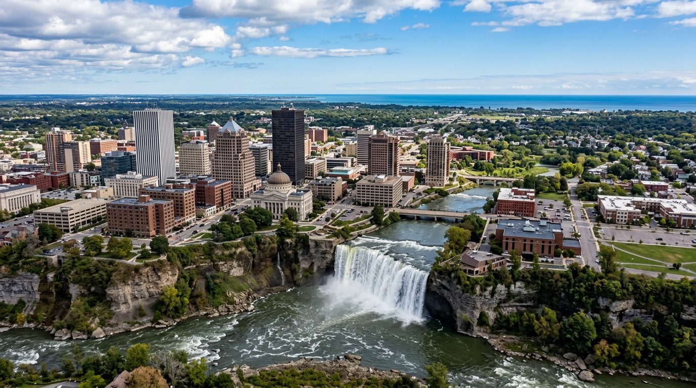
Current real estate market data, news and analysis for the Rochester, NY metropolitan area — 1.1M residents across 5 counties in New York.
Data as of May 2026. Sources: Redfin Data Center, U.S. Census Bureau.
Latest Rochester Real Estate News
Rochester Real Estate Market Overview
The Rochester metro sits on Lake Ontario’s southern shore at the mouth of the Genesee River, with the Finger Lakes beginning inland to the south. The lakeshore area is a gently rolling glacial plain that rises into drumlin hills further from the water. Lake Ontario moderates the climate somewhat, keeping summers from extreme heat, but the same lake effect produces significant snowfall in winter, particularly to the east and southeast. The city’s historic core — downtown and surrounding neighborhoods along the Genesee and the Erie Canal corridor — holds a dense stock of 19th- and early-20th-century homes. Inner-ring suburbs largely built up in the mid-20th century, while outer suburbs to the east and south have continued to add newer construction. Farmland, small villages, and lakeside hamlets fill out the rural counties surrounding the urban core.
The metro’s most established, highest-demand suburbs sit east and southeast of the city, prized for top-rated schools, historic housing stock, walkable village centers, and, in one case, direct Erie Canal frontage. Other eastern and northeastern suburbs with newer construction and strong schools also command a premium. The City of Rochester itself and the older inner-ring suburbs immediately surrounding it tend to be more affordable, generally reflecting older housing stock in more varied condition and a comparatively lower tax base than the newer suburbs further out. The more rural counties at the metro’s edges are typically the most affordable, a function of distance from the region’s job centers and a thinner base of local amenities.
The University of Rochester, including its academic medical center, is the region’s largest employer by a wide margin, and a second major hospital system operates multiple facilities across the metro. Rochester built its economy around imaging and optics, and that legacy persists today in a dense regional cluster of optics and photonics companies anchored by the University of Rochester’s Institute of Optics; a historic film and imaging company and a global technology company both remain headquartered in the area, alongside a large grocery chain and a payroll-services company. Higher education is well represented beyond the University of Rochester, with a major technology-focused university and several other colleges in the metro.
Lake-effect snow is a routine seasonal factor, heavier in lake-adjacent and southeastern parts of the metro, and worth weighing when considering driveway access, roof condition, and snow-removal costs. Flooding is a periodic concern along the Genesee River and the Lake Ontario shoreline during high-water years. Property tax rates in the core county run notably above state and national norms, driven largely by school-district levies that vary meaningfully from town to town, so it’s worth confirming the specific combined rate for a parcel rather than assuming a metro average. Transit is bus-only and regional, leaving most of the metro car-dependent. The city has also been reworking a 1960s-era expressway loop to reconnect neighborhoods it once divided, part of a broader push toward denser, more walkable zoning downtown. Buyers of older city and inner-ring homes should check for aging wiring, plumbing, and sewer laterals, and those in the rural fringe should confirm well and septic status.
Cities and Towns in the Rochester Metro Area
Notable Communities and Neighborhoods
Rochester Real Estate Market FAQ
How is the Rochester metro housing market organized?
The market runs from a historic urban core along the Genesee River and Erie Canal outward through mid-century inner-ring suburbs to newer eastern and southern suburbs, with farmland and lakeside hamlets across the rural outer counties. Housing age and lot size generally increase moving away from downtown.
Which parts of the Rochester area tend to be more expensive?
The established suburbs east and southeast of the city, known for top-rated schools and historic or newer housing stock, sit at the top of the market. The city of Rochester and its immediate inner-ring suburbs tend to be more affordable, and the rural outer counties are generally the most affordable.
What should buyers verify before purchasing in the Rochester metro?
Confirm the combined property tax rate for the specific town and school district, since rates vary significantly across the metro. Older city and inner-ring homes should be checked for aging wiring, plumbing, and sewer laterals, and rural-fringe buyers should verify well and septic status.
How does lake-effect snow affect homeownership in the Rochester area?
Snowfall is heaviest in lake-adjacent and southeastern parts of the metro, less so further inland. It’s worth factoring typical snow exposure into decisions about driveway layout, roof condition, and ongoing snow-removal costs for a specific address.
Nearby Markets