
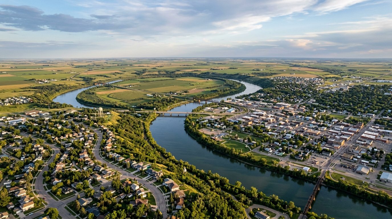
Current real estate market data, news and analysis for the Minot, ND metropolitan area — 75,694 residents across McHenry, Renville and Ward counties.
Data as of May 2026. Sources: Redfin Data Center, U.S. Census Bureau.
Latest Minot Real Estate News
Coverage of this market is coming soon. Browse all housing market news.
Minot Real Estate Market Overview
The Minot metropolitan area covers Ward, McHenry, and Renville counties in north-central North Dakota, with the city of Minot as its urban core. The city sits on the Drift Prairie along the Souris River (also called the Mouse River), which loops through the community and splits it into a north side and a south side connected by bridges. Surrounding land is flat, open farmland typical of the northern Plains. Minot’s housing stock reflects successive building eras: early twentieth-century homes cluster near downtown and the river valley, post-World War II ranch and split-level houses fill the North Hill and South Hill areas, and newer subdivisions have been added on higher ground since the early 2010s, partly as replacement housing after flood damage displaced valley residents.
Elevation relative to the Souris River is a consistent dividing line in local pricing patterns. South Hill and adjoining southwest Minot subdivisions sit on higher ground away from the historic floodplain and include a larger share of newer construction, which places them toward the upper end of the local market. North Hill similarly benefits from elevation and has seen infill and new subdivision activity. Neighborhoods closer to the river valley and downtown, including older sections built before modern flood-control infrastructure, tend to carry lower price points, reflecting both the age of the housing stock and residual buyer caution about flood history. West Minot and other valley-floor areas fall into this more moderate tier.
Minot’s economy is anchored by Minot Air Force Base, home to the 5th Bomb Wing and the 91st Missile Wing, which together make the base one of the largest employers and economic drivers in the region and a defining feature of local housing demand. Trinity Health operates the area’s primary hospital system and is among the largest civilian employers. Minot Public Schools and Minot State University are major public-sector employers, and SRT Communications, a locally based telecommunications cooperative, is headquartered in the city. The regional economy also draws on agriculture and grain handling, supported by BNSF Railway’s rail yard and an Amtrak Empire Builder stop, and on service and supply activity tied to the Bakken oil-producing counties to the west.
The Souris River’s flood history is a central consideration for property buyers: a major flood in 2011 inundated thousands of homes across the valley, and earlier flooding in 1969 prompted upstream reservoir and dam construction. Federal, state, and local flood-protection projects have continued in the years since, and buyers should verify a property’s floodplain status, elevation, and flood-insurance requirements before purchasing. North Dakota has no state income tax, and local government is funded primarily through property taxes administered at the county and city level. Public transit is limited to a small city transit system supplemented by regional highway and rail connections. Because a large share of the population is tied to Minot Air Force Base, including a multiyear Sentinel missile modernization program bringing added construction workers to the area, rental and housing demand can fluctuate with military deployment cycles, base construction phases, and personnel turnover.
Cities and Towns in the Minot Metro Area
Notable Communities and Neighborhoods
Minot Real Estate Market FAQ
How is the Minot housing market organized?
Minot is generally divided into North Hill, South Hill, and the Souris River Valley that runs between them, with each area encompassing a set of named neighborhoods and subdivisions. Elevation relative to the river and distance from the historic floodplain are the main organizing features of the local market, more so than distinct urban-suburban divides.
Which parts of the Minot area tend to be pricier?
Higher ground on South Hill and in newer southwest Minot subdivisions, along with parts of North Hill that have seen recent infill and new construction, tend to sit toward the upper end of local pricing. Older neighborhoods closer to the river valley and downtown tend to be more moderately priced, reflecting the age of the housing stock and historic flood exposure.
What should buyers verify before purchasing in the Minot area?
Buyers should confirm a property’s floodplain designation and elevation relative to the Souris River, check whether flood insurance is required or advisable, review the age and condition of the housing stock in valley-floor neighborhoods built before current flood-control infrastructure, and confirm property tax mill levies with the county, since North Dakota funds local government primarily through property taxes rather than a state income tax.
How do flooding history and military activity affect the local market?
The Souris River has produced significant flooding historically, most notably in 2011 and 1969, which reshaped development patterns and pushed newer building toward higher ground. Separately, because Minot Air Force Base and its associated personnel represent a large share of area housing demand, rental vacancy and turnover can shift with deployment schedules, base housing policy, and major construction programs at the base such as the ongoing missile-system modernization work.
Nearby Markets