
Current real estate market data, news and analysis for the Huntington-Ashland, WV-KY-OH metropolitan area — 365,965 residents across 8 counties in West Virginia, Kentucky and Ohio.
Data as of May 2026. Sources: Redfin Data Center, U.S. Census Bureau.
Latest Huntington Real Estate News
Coverage of this market is coming soon. Browse all housing market news.
Huntington Real Estate Market Overview
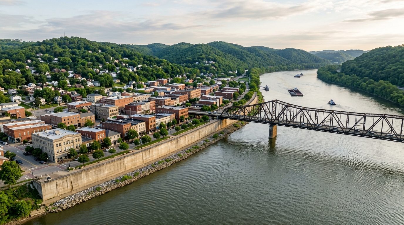
Huntington-Ashland sits where West Virginia, Kentucky, and Ohio meet along a wide bend of the Ohio River, with the Guyandotte and Big Sandy rivers feeding in nearby. The land rises quickly from the river’s floodplain into folded, wooded Appalachian foothills, so the built environment reads as flat valley shelves separated by steep, forested ridgelines. Housing reflects that layered geography and a long industrial past: brick bungalows, foursquares, and Craftsman homes fill the older grid neighborhoods near the river and rail lines, hillside sections carry larger period homes with mature trees and winding streets, and the outer counties mix mid-century ranches with newer subdivisions on cleared upland or valley-floor sites. Small river towns on both the Kentucky and Ohio banks add their own stock of modest frame and brick houses from the same manufacturing era.
Higher-value housing tends to cluster on Huntington’s hillside neighborhoods near Marshall University and the city’s larger park, where mature landscaping, architectural detail, and walkable streets carry a premium, and in the Putnam County suburbs east of the core cities, where newer construction, larger lots, and highly regarded schools draw commuters. Lower-cost housing is concentrated in the older industrial river neighborhoods and in the smaller Kentucky and Ohio river towns, where homes tend to be older, lots smaller, and proximity to legacy manufacturing and rail corridors more pronounced. Ashland’s older residential blocks near its downtown core occupy a middle tier, trading on historic character even as the surrounding commercial district has contracted.
The metro’s economy still centers on the institutions and industries that grew up along the river. Marshall University, including its medical school, anchors education and drives a large share of professional employment, while regional hospital systems built around Cabell Huntington Hospital, St. Mary’s Medical Center in Huntington, and King’s Daughters in Ashland make healthcare the area’s dominant employment sector. Heavy industry persists alongside these institutions: a large nickel-alloy plant on Huntington’s riverfront, a major petroleum refinery at Catlettsburg, and an automotive components plant in Putnam County all remain significant employers, and rail operations tied to the historic Chesapeake and Ohio corridor keep freight and locomotive work rooted in Huntington. Barge traffic on the Ohio River continues to move coal, chemicals, and bulk goods, reinforcing the corridor’s long-standing role in regional logistics.
Because the core cities sit directly on the Ohio River, flood exposure is a defining consideration; floodwalls and levees protect much of Huntington, Ashland, and the smaller river towns, but property outside those protected zones, along tributary creeks, or on lower ground can still flood, so buyers should confirm a home’s flood-zone status and whether it lies inside a protected district. Hillside neighborhoods carry their own concerns around slope stability, retaining walls, and drainage worth a specific inspection. Because the metro spans three states, property taxes, income taxes, school funding, and permitting rules differ depending on which state and county a property sits in, so buyers should verify the taxing jurisdiction directly rather than assume consistency across the region. Public transit is limited and the area is largely car-dependent, so commute patterns and road access matter as much as school assignment. Development has skewed toward the Putnam County side of the metro in recent years, while the older river-city cores have seen slower, more selective reinvestment.
Cities and Towns in the Huntington Metro Area
Notable Communities and Neighborhoods
Huntington Real Estate Market FAQ
How is the Huntington-Ashland market organized across three states?
The metro spans Cabell, Putnam, and Wayne counties in West Virginia, Boyd, Carter, Greenup, and Lawrence counties in Kentucky, and Lawrence County in Ohio, unified by the Ohio River but split into three separate tax, school, and permitting systems. Huntington and Putnam County anchor the West Virginia side, Ashland and Catlettsburg anchor the Kentucky side, and Ironton anchors the Ohio side, with the river and connecting bridges tying the daily economy together even though each side operates under its own state and county rules.
Which areas tend to be pricier and why?
Hillside neighborhoods in Huntington near Marshall University and the city’s largest park command a premium for mature landscaping, architectural character, and walkability, while the Putnam County suburbs east of the core cities draw a premium for newer construction, larger lots, and well-regarded schools. Older industrial river neighborhoods and the smaller river towns on the Kentucky and Ohio sides generally sit at the lower end, reflecting older housing stock and proximity to legacy manufacturing and rail corridors.
What should buyers verify locally before purchasing?
Buyers should confirm a property’s flood-zone status and whether it sits inside a protected floodwall or levee district, check slope stability and drainage on any hillside lot, and verify which state and county governs the property since property taxes, income taxes, school funding, and permitting differ across the three-state footprint. It is also worth checking the age of local water and sewer infrastructure in older river towns and confirming road access and commute routes given the area’s limited public transit.
What is the region-specific risk buyers should understand?
River flooding is the defining local risk given the metro’s position on the Ohio River at its confluence with the Guyandotte and Big Sandy rivers. Floodwalls and levees protect much of Huntington, Ashland, and several smaller river towns, but areas outside those protected zones, along feeder creeks, or on lower ground remain exposed, so buyers should check flood maps and levee district boundaries for any specific property rather than assume the whole metro is protected.
Nearby Markets