
Current real estate market data, news and analysis for the Gadsden, AL metropolitan area — 103,886 residents across Etowah county.
Data as of May 2026. Sources: Redfin Data Center, U.S. Census Bureau.
Latest Gadsden Real Estate News
Coverage of this market is coming soon. Browse all housing market news.
Gadsden Real Estate Market Overview
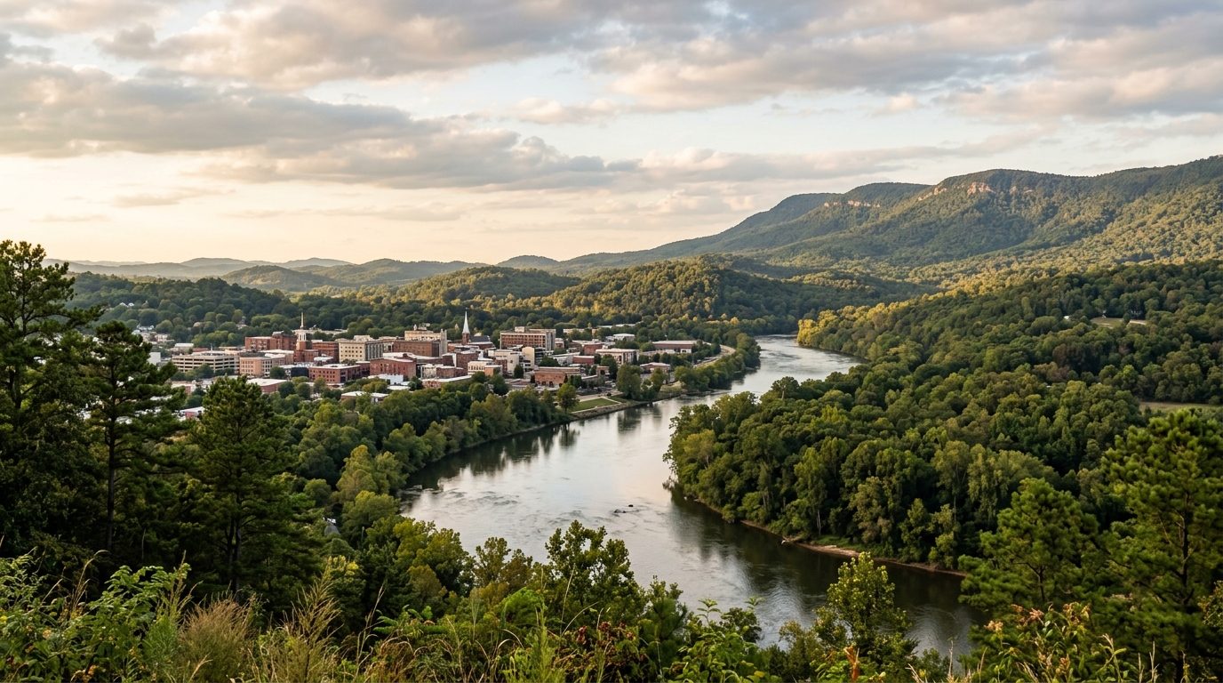
The Gadsden metro area covers Etowah County in northeastern Alabama, where the Coosa River winds through the foothills of the Appalachian Plateau. Gadsden sits along a bend in the river, with land rising toward Lookout Mountain and wooded hills spreading toward the surrounding towns. The housing stock reflects this layered history: brick bungalows, worker cottages, and craftsman-style homes from the early twentieth century cluster in historic districts near downtown, built during the city’s industrial era. These sit alongside postwar ranch houses and newer subdivisions on former farmland around towns such as Rainbow City, Southside, and Glencoe. Manufactured and modular homes are more common in the county’s rural stretches, away from the incorporated towns.
Price tiers vary with terrain and proximity to water. Areas along the Coosa River and Neely Henry Lake, including waterfront subdivisions near Whorton Bend, tend to command a premium for water access, boat docks, and views, as do wooded hillside lots on the lower slopes of Lookout Mountain, where larger parcels and privacy are easier to find. Downtown Gadsden’s historic core offers older, architecturally distinct housing at a more accessible price point, reflecting the smaller lots typical of an industrial-era street grid. Outlying rural areas farther from the river and commercial core, toward the county line and into agricultural stretches, tend to offer more acreage and lower costs, trading proximity to shopping and hospitals for space and quiet. Suburban towns positioned between the two, such as Rainbow City and Southside, generally offer newer construction and easier highway access.
The local economy has long been tied to manufacturing, though its shape has changed. Goodyear operated a large tire plant in Gadsden for most of the twentieth century, and its presence shaped much of the city’s growth and civic identity even after the plant closed. Manufacturing remains part of the base today through food processing operations such as Koch Foods and Tyson Foods, along with automotive-parts suppliers serving the broader Southeastern auto industry. Healthcare is another pillar, anchored by Gadsden Regional Medical Center and Riverview Regional Medical Center, drawing patients and employees from across the county. Gadsden State Community College, based in Gadsden, is a significant local employer and a source of workforce training in fields such as nursing and industrial technology. Public school systems and city and county government round out the largest employment sectors.
Etowah County has a humid subtropical climate, with hot, humid summers and mild winters interrupted by occasional cold snaps. Severe thunderstorms and tornadoes are a seasonal risk in this part of Alabama, and buyers should factor storm history and shelter options into their planning. Flood risk is a real consideration near the Coosa River and Neely Henry Lake; water levels are managed for flood control but can still rise during heavy rain, so flood zone status and insurance requirements are worth confirming for riverside or low-lying property. Property taxes in Alabama, including Etowah County, are relatively low by national standards, though rates differ between municipalities and unincorporated areas. Zoning also varies: cities such as Gadsden and Rainbow City have more formal zoning and utility infrastructure, while unincorporated parts of the county may rely on private wells, septic systems, and looser land-use rules. Buyers should verify flood zone designation, water and sewer service, school zoning, and tax jurisdiction before making an offer.
Cities and Towns in the Gadsden Metro Area
Notable Communities and Neighborhoods
Gadsden Real Estate Market FAQ
How is the Gadsden metro area organized geographically?
Etowah County is centered on the Coosa River, with Gadsden as the county seat sitting along a bend in the river near the southern end of Lookout Mountain. Smaller towns ring the city in different directions: some, like Rainbow City and Southside, sit along or near the river to the south and east; others, like Attalla and Glencoe, spread west and northeast along the highway corridors; and towns such as Hokes Bluff, Altoona, and Sardis City occupy more rural, hillier ground toward the county’s edges. Terrain shifts fairly quickly across the county, from flat riverside bottomland to steep, wooded foothill terrain near the mountain.
Which parts of the Gadsden area tend to be pricier, and why?
Property directly on the Coosa River or Neely Henry Lake, and land on the lower slopes of Lookout Mountain, tend to sit at the higher end locally because water access and elevated, wooded terrain are limited and in demand. Established suburban towns with newer housing stock and convenient highway access also tend to price above the older core of Gadsden. The most affordable options are generally in the oldest sections of the city, where housing is smaller and dates to the early industrial era, and in outlying rural parts of the county farthest from shopping, hospitals, and employment centers.
What should buyers verify locally before purchasing in the Gadsden area?
Because the county mixes incorporated cities with unincorporated rural land, buyers should confirm whether a property is served by city water and sewer or relies on a private well and septic system, and whether it falls under city or county zoning and tax jurisdiction. It is also worth checking school zone assignment, road maintenance responsibility for rural properties, and, for anything near the river or lake, flood zone status and any homeowners’ association rules for platted subdivisions.
What is the main environmental risk to be aware of in this market?
Flooding along the Coosa River and Neely Henry Lake is the primary local risk. Lake levels are managed for flood control, but heavy rain events can still push water into low-lying areas near the riverbank. Buyers considering waterfront or low-elevation property should check flood zone maps and flood insurance requirements directly with local authorities rather than assuming a property is unaffected simply because it has not flooded recently.
Nearby Markets