Drone photography has become a common real estate marketing tool, but it works best when it adds information buyers cannot get from ordinary photos.
Aerial images can show lot size, roof condition from above, property orientation, water frontage, acreage, outbuildings, neighborhood context, commercial access or proximity to amenities. But drone photos are not automatically useful. A small condo, a dense neighborhood or a home with nothing meaningful to show from above may not need aerial marketing.
The best real estate drone photography answers a buyer’s question, not just a seller’s desire for dramatic visuals.
Key takeaways
- NAR’s 2025 Technology Survey found drone photography and video were used by 52% of agents who are REALTORS®.
- Commercial drone use generally requires FAA Part 107 compliance.
- FAA says drone pilots operating under Part 107 must obtain a Remote Pilot Certificate.
- FAA says Part 107 pilots flying at night need anti-collision lighting visible for three miles.
- Drones required to register or already registered must comply with Remote ID.
- Drone photography works best when it shows land, location, layout or property context.
Why drone photography is popular
Drone photography gives buyers a perspective they cannot get from street-level photos.
NAR’s 2025 Technology Survey found that 52% of agents who are REALTORS® use drone photography and video. That placed drones among the widely used real estate technology tools, alongside eSignature, social media and AI-generated content.
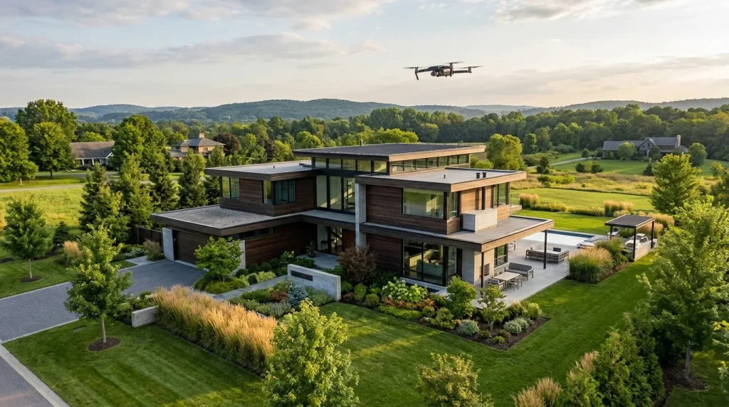
Aerial visuals can help buyers understand lot boundaries, acreage, views, waterfront or golf-course positioning, commercial access, nearby roads, surrounding land uses, farm or ranch features, large estates, new-construction communities and exterior amenities.
Drone video can also help create a stronger first impression for social media and listing pages.
When drone photos add value
Drone photography is most useful when the property’s value depends partly on what surrounds it.
Strong drone candidates include acreage properties, waterfront homes, farms and ranches, luxury estates, commercial buildings, development sites, large lots, homes with pools or outdoor amenities, mountain or view properties, new subdivisions and properties near parks or major amenities.
For a small urban condo, drone photography may add less value unless the building, skyline, amenities or neighborhood context are important selling points.
FAA rules matter
Real estate drone photography is generally commercial use.
The FAA says that to fly a drone under the Small UAS Rule, Part 107, a pilot must obtain a Remote Pilot Certificate from the FAA. The certificate demonstrates that the pilot understands regulations, operating requirements and procedures for safely flying drones.
NAR’s drone guidance also notes that real estate professionals operating drones commercially must obtain a Remote Pilot Certificate with a small UAS rating from the FAA, and generally drones may be flown no higher than 400 feet above ground level or within 400 feet of a structure’s uppermost limit.
Agents should not assume that owning a drone is enough. The operator must follow applicable FAA rules.
Night flights, people and Remote ID
Drone rules are more detailed than many listing teams realize.
FAA guidance says Part 107 certificated remote pilots flying at night must equip the drone with anti-collision lighting visible for three miles. Remote ID is another issue. FAA says drones that are required to register, or have been registered, must comply with the Remote ID rule.
For real estate professionals, the practical rule is simple: hire a qualified drone operator and confirm compliance.
What actually helps listings stand out
The most useful drone shots are not always the highest or most cinematic.
A good drone plan should include an establishing shot of the home, property-boundary context if appropriate, key outdoor features, driveway and access points, proximity to water, parks or major roads, roof and exterior context without overclaiming condition, neighborhood orientation and a short video path that helps buyers understand layout.
Drone imagery should support the listing story. If the home’s main value is interior design, floor plan or renovation quality, traditional photography may matter more than aerial footage.
What this means
Drone photography can help listings stand out when aerial context matters.
It is strongest for properties where land, location, exterior amenities or surrounding context influence value. It is weaker when used only because aerial footage looks trendy.
For agents and sellers, the best drone strategy is targeted: use aerial images when they answer buyer questions, follow FAA rules, and keep the listing accurate.
FAQ
Is drone photography useful in real estate? Yes, when it shows useful property context such as acreage, waterfront, views, exterior amenities, neighborhood layout or commercial access.
Do real estate drone pilots need FAA certification? For commercial drone operations under Part 107, FAA says pilots must obtain a Remote Pilot Certificate.
How high can a real estate drone fly? NAR’s drone guidance says drones generally may be flown no higher than 400 feet above ground level, or within 400 feet of a structure’s uppermost limit.
Can drones fly at night for real estate photography? Yes, under applicable FAA rules. FAA says Part 107 pilots flying at night must use anti-collision lighting visible for three miles.
Should every listing use drone photography? No. Drone photography is most useful when aerial context adds real buyer value.
Sources with clickable URLs
- FAA — Become a Certificated Remote Pilot
- FAA — Remote ID
- FAA — Operations Over People and Night Operations
- NAR — Drones in Real Estate
- NAR — 2025 Technology Survey