
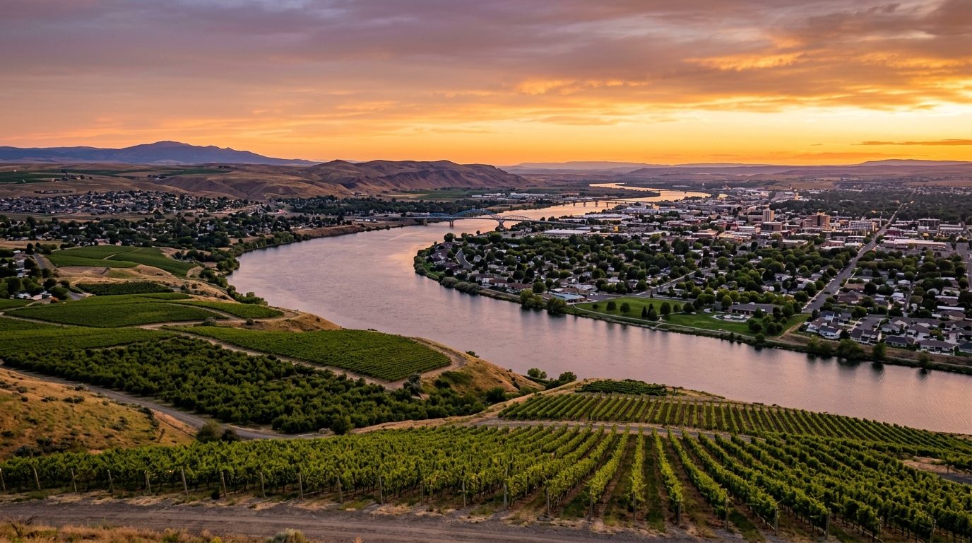
Current real estate market data, news and analysis for the Kennewick-Richland, WA metropolitan area — 324,334 residents across Benton and Franklin counties.
Data as of May 2026. Sources: Redfin Data Center, U.S. Census Bureau.
Latest Kennewick Real Estate News
Coverage of this market is coming soon. Browse all housing market news.
Kennewick Real Estate Market Overview
The Kennewick-Richland metro, known locally as the Tri-Cities, sits at the confluence of the Columbia, Snake, and Yakima rivers in the high desert of southeastern Washington. Richland and Kennewick sit on the west and south banks of the Columbia, Pasco sits across the river to the east, and West Richland, Prosser, and Benton City round out the metro’s smaller incorporated towns. The terrain is flat, dry, and shrub-steppe in character, a stark contrast to the wetter western half of the state, and irrigation has turned the surrounding land into some of the Pacific Northwest’s most productive farm and vineyard country. Housing here skews newer than in many Western metros, with rapid suburban growth on the edges of all three core cities pressing into what was recently open agricultural land.
Richland’s golf-course neighborhoods, associated historically with the area’s scientific and engineering workforce, and Kennewick’s Canyon Lakes and South Hill areas are generally regarded as the metro’s more established, higher-end addresses. Newer growth corridors — Southridge in Kennewick and the Road 68 and Broadmoor areas of Pasco — are drawing much of the metro’s new construction and tend to be more attainable, reflecting their newer, faster-building status rather than any lack of amenities. Rural land at the edges of the metro, particularly in Franklin County and around Benton City and Prosser, carries an agricultural character and a different price dynamic tied to irrigation and farmland rather than residential demand.
The Hanford Site, the sprawling federal reservation along the Columbia River that traces back to the Manhattan Project era, remains the region’s most distinctive economic anchor, today employing thousands through the long-running environmental cleanup managed by the U.S. Department of Energy and contractors including Washington River Protection Solutions and Bechtel National. Pacific Northwest National Laboratory, based in Richland, adds a substantial research and engineering workforce to that base. Food processing and agriculture are equally important, led by Lamb Weston’s corporate and manufacturing presence, and the surrounding Yakima Valley and Red Mountain wine-growing areas have built a substantial wine industry with dozens of wineries in the region.
Because this is a desert climate, drought and wildfire are ongoing regional concerns, and the state has periodically declared drought emergencies affecting the broader Yakima and Columbia Basin watershed. Anyone buying agricultural or rural land here should verify water rights and irrigation-district status directly, since access to water shapes both what can be farmed and what a parcel is worth. The long-running Hanford cleanup includes active groundwater monitoring and treatment near the river, and while it sits well north of the residential core, buyers with specific questions about the site’s environmental programs can find current information through the Department of Energy. Rapid growth in west Pasco and other new-construction corridors also means infrastructure like schools and roads is still catching up in places, worth asking about directly rather than assuming it matches the pace of new rooftops.
Cities and Towns in the Kennewick Metro Area
Notable Communities and Neighborhoods
Kennewick Real Estate Market FAQ
How is the Tri-Cities metro organized?
Richland and Kennewick sit on the west and south banks of the Columbia River, Pasco sits across the river to the east, and West Richland, Prosser, and Benton City are smaller outlying towns amid irrigated farmland.
Which parts of the Tri-Cities tend to be pricier?
Richland’s established golf-course neighborhoods and Kennewick’s Canyon Lakes and South Hill areas are generally viewed as the metro’s higher-end addresses, while newer growth corridors like Southridge and the Road 68 area are more attainable.
What should buyers verify before purchasing here?
For any agricultural or rural parcel, confirm water rights and irrigation-district status directly, since access to water affects both use and value in this desert climate.
What regional risk factor is most relevant?
Drought and wildfire risk tied to the region’s high-desert climate, along with periodic state-declared drought emergencies affecting the broader Yakima and Columbia Basin watershed.
Nearby Markets