
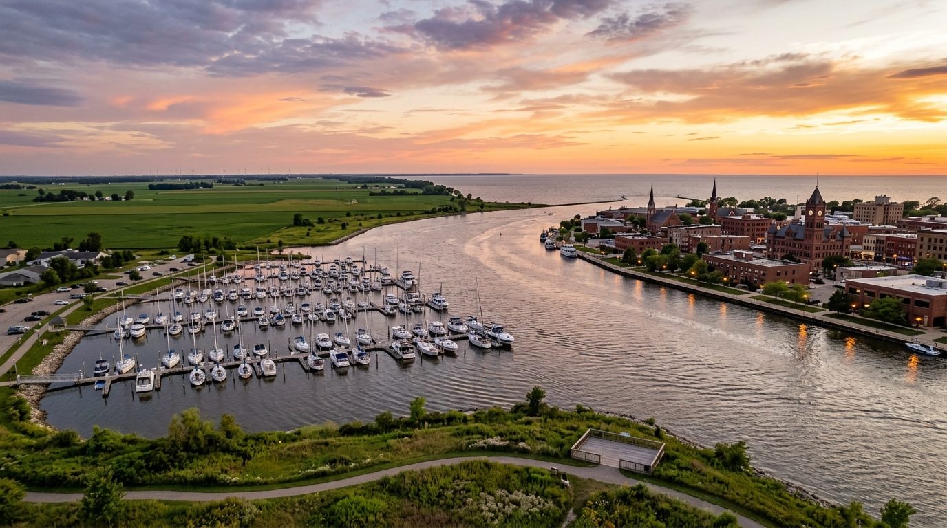
Current real estate market data, news and analysis for the Bay City, MI metropolitan area — 102,123 residents across Bay county.
Data as of May 2026. Sources: Redfin Data Center, U.S. Census Bureau.
Latest Bay City Real Estate News
Coverage of this market is coming soon. Browse all housing market news.
Bay City Real Estate Market Overview
Bay City sits where the Saginaw River widens and empties into Saginaw Bay, the shallow arm of Lake Huron that anchors Michigan’s Tri-Cities region alongside Saginaw and Midland. The surrounding land is flat glacial lake plain, given over to row-crop and sugar beet farming once it moves beyond the built-up river corridor. The housing stock still carries the imprint of the lumber era that built the city: substantial Victorian and Queen Anne houses along Center Avenue, alongside smaller worker cottages platted the same period near the old mills and shipyards. Downtown retains a dense, walkable grid dating to the early-20th-century consolidation of Bay City and West Bay City. Outside the historic core, mid-century ranch homes and newer subdivisions give way to open farmland and shoreline cottages.
Within Bay City, the Center Avenue Neighborhood Residential District and the streets nearest the river sit in the highest price tier, reflecting large architect-built homes, mature tree canopy, and walking access to downtown and the riverfront. Waterfront and near-waterfront parcels along Saginaw Bay and the lower Saginaw River also command a premium wherever they offer direct water access or views. Older working-class neighborhoods closer to the former industrial corridor, such as Banks, South End, and Salzburg, sit lower, shaped by smaller lots and older infrastructure. Essexville, adjoining Bay City, and newer subdivisions in townships such as Frankenlust, Monitor, and Williams occupy a middle tier of suburban housing on larger lots. Farther out, the rural stretches around Auburn and Pinconning trade smaller farmhouses for distance and acreage, keeping value oriented toward land rather than finished suburban housing.
Bay City’s economy still leans on the industrial base the lumber and shipbuilding era left behind, now diversified into manufacturing, agribusiness, health care, and tourism. McLaren Bay Region operates the area’s main hospital campus and ranks among the county’s largest employers. Manufacturing remains significant, with a General Motors powertrain plant, the Bay Cast foundry, Mersen USA’s carbon and graphite operations, and an SC Johnson production facility among the larger industrial employers in and around the city. Michigan Sugar Company, headquartered in Bay City, processes sugar beets grown across the surrounding farmland, tying the local economy directly to the agricultural land around it. Saginaw Bay itself supports a tourism economy built on boating, sportfishing, and waterfront events centered on Wenonah Park and the downtown riverfront.
The climate follows a typical inland Great Lakes pattern, with cold, snowy winters influenced by lake-effect moisture off Saginaw Bay and warm, humid summers. Low-lying land along the Saginaw River and the bay shoreline carries flood risk from spring snowmelt, heavy rainfall, and periodic high lake levels, and Bay County maintains flood zone mapping that buyers should consult for any parcel near the water. Michigan’s property tax system caps annual increases in taxable value while a home is owned but resets that value at sale, so buyers should confirm current taxable value and millage with the local assessor rather than the seller’s existing bill. Zoning ranges from design-review requirements within Bay City’s historic districts to conventional township zoning in outlying areas, where buyers should also confirm whether a property relies on municipal water and sewer or a private well and septic system.
Cities and Towns in the Bay City Metro Area
Notable Communities and Neighborhoods
Bay City Real Estate Market FAQ
How is the Bay City housing market organized geographically?
The market centers on Bay City itself, where the Saginaw River meets Saginaw Bay, then radiates outward into a ring of townships and small cities including Essexville, Auburn, and Pinconning. Housing character shifts from dense, historic in-city neighborhoods with grid streets and older architecture to larger-lot suburban and rural properties as you move away from the river toward the flat farmland that surrounds the metro.
Which areas tend to be more expensive, and why?
Homes in Bay City’s historic Center Avenue district and along the Saginaw River and Saginaw Bay shoreline tend to command higher prices, largely because of architectural pedigree, larger lots, mature landscaping, and direct or near water access. Newer suburban subdivisions in the surrounding townships also trade at a premium over the city’s older working-class neighborhoods, reflecting updated construction and larger lot sizes.
What should buyers verify before purchasing in this area?
Buyers should confirm a property’s flood zone status with Bay County, especially anywhere near the Saginaw River or Saginaw Bay shoreline, and check current taxable value and millage rates with the local assessor rather than relying on the seller’s tax bill. In outlying townships, buyers should also confirm whether the property uses municipal water and sewer or relies on a private well and septic system, and homes within a designated historic district may be subject to local design-review rules for exterior changes.
What is the main environmental risk to be aware of in this market?
The primary risk is flooding tied to the Saginaw River and Saginaw Bay, driven by spring snowmelt, heavy rainfall, and periodic high Great Lakes water levels that can affect low-lying riverfront and shoreline properties. Winters also bring lake-effect snow and freeze-thaw cycles that put stress on the older housing stock common in the city’s historic neighborhoods, making roof, foundation, and drainage condition worth close inspection.
Nearby Markets