
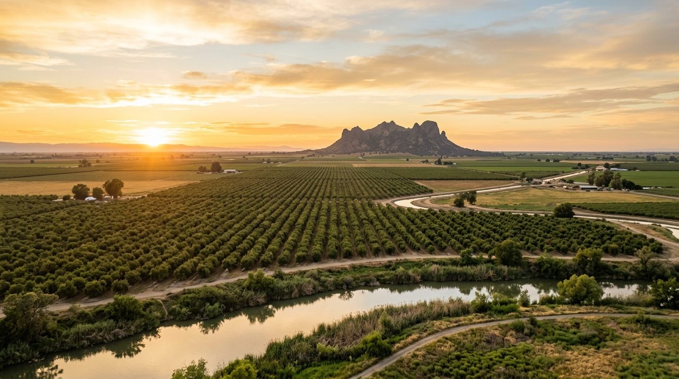
Current real estate market data, news and analysis for the Yuba City, CA metropolitan area — 187,478 residents across Sutter and Yuba counties.
Data as of May 2026. Sources: Redfin Data Center, U.S. Census Bureau.
Latest Yuba City Real Estate News
Coverage of this market is coming soon. Browse all housing market news.
Yuba City Real Estate Market Overview
Yuba City anchors a Sacramento Valley metro built around Sutter and Yuba counties, sitting north of the state capital along Highway 99 and State Route 70. The Feather River divides Yuba City from its older sister city, Marysville, while the Sutter Buttes rise abruptly from the flat valley floor to the west, a compact volcanic formation often described as the smallest mountain range in the world. The metro also takes in the smaller communities of Live Oak and Wheatland, both ringed by orchards and row-crop farmland that give the region its agricultural character. Housing stock ranges from modest ranch-style homes built on former orchard ground near the urban core to newer subdivisions of stucco-and-tile suburban houses on Yuba City’s outer edges, alongside a pocket of aging Victorian and Craftsman-style homes in Marysville’s historic downtown blocks.
Newer subdivisions on the outskirts of Yuba City and in planned communities such as Plumas Lake in Yuba County tend to sit toward the higher end of the local price spectrum, reflecting larger lots, contemporary construction, and levee protection built to more current flood-control standards. These areas were developed later in part because they lie outside the oldest, most flood-exposed ground along the rivers. Older neighborhoods closer to the historic cores of Yuba City and Marysville, along with river-adjacent communities such as Linda and Olivehurst, tend to sit toward the lower end; housing stock there is older, lots are smaller, and proximity to rail and industrial corridors can weigh on desirability. Live Oak and Wheatland offer a more rural, small-town alternative removed from either city center.
Agriculture remains the backbone of the local economy, with the surrounding valley producing rice, walnuts, peaches, prunes, and processing tomatoes. Sunsweet Growers, which operates a major dried-fruit processing facility in Yuba City, is among the region’s signature employers, alongside health systems Adventist Health and Rideout and Sutter North Medical Foundation. Government employment is substantial given the presence of Sutter County, Yuba County, Caltrans offices, and Beale Air Force Base, a major installation in Yuba County that supports both military and civilian jobs. Education and retail round out the base, with Yuba College, Marysville Joint Unified School District, and large retailers such as Walmart among the area’s bigger employers, while tribal gaming contributes through the Hard Rock Hotel & Casino near Marysville.
Flood management shapes much of how the metro is built and regulated: large sections of Yuba City and the surrounding valley sit behind levees maintained by local flood-control and reclamation districts, so buyers should confirm a property’s flood-zone designation and whether flood insurance is required. Newer master-planned neighborhoods, including Plumas Lake, may carry special assessment districts that help fund infrastructure and levee improvements, so reviewing property tax bills for those charges is worthwhile. Rural parcels around Live Oak, Wheatland, and Sutter can rely on private wells and septic systems rather than municipal utilities, which buyers should verify before purchase. The valley’s hot, dry summers and dense wintertime tule fog are routine seasonal conditions that affect utility costs and travel planning rather than emergencies. The metro is also home to one of the largest Sikh communities in the United States, centered in Yuba City, which shapes local culture and draws a major annual gathering.
Cities and Towns in the Yuba City Metro Area
Notable Communities and Neighborhoods
Yuba City Real Estate Market FAQ
How is the Yuba City, CA metro area organized geographically?
The metro spans Sutter and Yuba counties in the Sacramento Valley and is anchored by Yuba City and Marysville, which sit across the Feather River from one another, along with the smaller communities of Live Oak and Wheatland. The Sutter Buttes, an isolated volcanic formation, rise from the valley floor west of Yuba City, while the Feather and Sacramento rivers and their levee systems define much of the developable land.
Which areas of Yuba City and Marysville tend to be pricier or more affordable, and why?
Newer subdivisions on Yuba City’s outer edges and planned communities such as Plumas Lake tend to command higher prices because they feature larger lots, newer construction, and levee protection built to more current standards. Older neighborhoods near the historic cores of Yuba City and Marysville, along with river-adjacent areas like Linda and Olivehurst, tend to be more affordable because the housing stock is older, lots are smaller, and these areas sit closer to rail and industrial corridors.
What should home buyers verify locally before purchasing in the Yuba City metro?
Buyers should confirm a property’s flood-zone designation and whether flood insurance is required, since much of the valley floor is protected by levees maintained by local flood-control and reclamation districts. In newer master-planned areas, it is worth checking property tax bills for special assessment districts that fund infrastructure and levee work, and in rural areas around Live Oak, Wheatland, and Sutter, buyers should confirm whether a property relies on a private well and septic system rather than municipal water and sewer service.
What is the biggest region-specific risk for property owners in the Yuba City metro?
The dominant local risk is flood exposure tied to the area’s location between the Feather and Sacramento rivers, which makes the integrity of local levee systems and flood-control districts a central consideration for property owners. The regional economy’s reliance on agriculture and a small number of large public employers, including Beale Air Force Base and county government, also means local job conditions are closely tied to those sectors.
Nearby Markets