
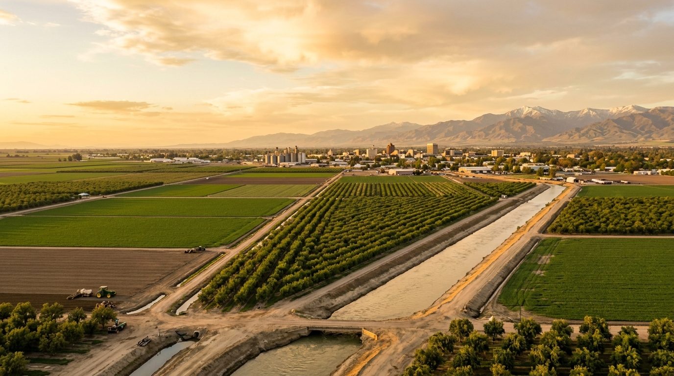
Current real estate market data, news and analysis for the Merced, CA metropolitan area — 297,260 residents across Merced county.
Data as of May 2026. Sources: Redfin Data Center, U.S. Census Bureau.
Latest Merced Real Estate News
Coverage of this market is coming soon. Browse all housing market news.
Merced Real Estate Market Overview
The Merced metro sits in California’s San Joaquin Valley, a flat agricultural plain bordered by the Merced River and threaded by the San Joaquin River, with Yosemite National Park roughly an hour east via Highway 140. The core cities of Merced, Atwater, Livingston, Los Banos, Dos Palos, and Gustine are separated by open farmland rather than continuous suburban sprawl, so each town retains a distinct edge where development gives way to orchards, dairies, and row crops. Housing stock reflects this layered growth: older cores in Merced, Atwater, and Los Banos hold modest postwar ranch-style and Craftsman-era homes on grid streets, while newer subdivisions on the fringes, particularly north Merced, feature stucco tract homes built from the 1990s onward with curvilinear streets and community parks. Smaller towns such as Livingston, Dos Palos, and Gustine mix older farmhouses, small-lot single-family homes, and manufactured housing tied to agricultural work.
Price tiers within the metro track distance from newer infrastructure and commute access more than any single factor. North Merced, including planned subdivisions near UC Merced, tends to sit at the higher end locally because homes are newer. Los Banos commands a relative premium because Highway 152 links it toward Bay Area job centers, drawing commuters willing to trade travel time for larger, newer homes. Older downtown cores in Merced and Atwater, along with small unincorporated communities like Winton, Planada, Delhi, Franklin-Beachwood, and Hilmar, tend to be more affordable, reflecting older housing stock and greater distance from major employment centers.
Agriculture anchors the regional economy, spanning dairy, poultry, almonds, tomatoes, and other row and tree crops grown on the valley floor. Major real employers include Foster Farms, headquartered and processing poultry in Livingston; E&J Gallo, with major wine and grape operations centered in Livingston; Hilmar Cheese Company in the unincorporated Hilmar area; and Dole Packaged Foods in Atwater. UC Merced, the newest campus in the University of California system, has grown into one of the county’s largest employers and a driver of new construction and housing demand in north Merced. Healthcare systems, led by Mercy Medical Center in Merced, along with county government and public education systems including Merced College, round out the largest non-agricultural employers.
Several distinctive local factors shape ownership here. Merced County lies within the San Joaquin Valley Air Basin, in federal nonattainment for ozone and particulate matter, making air quality a seasonal consideration during summer heat and fall harvest and wildfire-smoke periods. Portions of the metro near the Merced and San Joaquin Rivers sit within mapped flood zones protected by levee systems, so flood insurance requirements and levee certification are worth confirming property by property. The underlying groundwater subbasin is designated critically overdrafted under the state’s Sustainable Groundwater Management Act, and buyers relying on private wells or agricultural water should verify water rights and applicable sustainability restrictions. Property tax bills follow California’s standard Proposition 13 framework, and buyers should check whether a parcel carries a Williamson Act agricultural preserve contract, which affects taxation and future development rights. Public transit is limited outside Amtrak’s San Joaquins rail service and local bus systems, so most residents rely on cars, and much of the metro’s recent growth has been driven by Bay Area residents relocating along the Highway 99 and Highway 152 corridors in search of larger, less expensive homes.
Cities and Towns in the Merced Metro Area
Notable Communities and Neighborhoods
Merced Real Estate Market FAQ
How is the Merced metro area organized geographically?
The metro is a cluster of separate cities and small towns, Merced, Atwater, Livingston, Los Banos, Dos Palos, and Gustine, along with unincorporated communities like Winton, Planada, Hilmar, and Delhi, strung along Highway 99 and Highway 152 and separated by working agricultural land rather than continuous suburban development. Each city functions as its own local housing market with its own downtown core and newer edge subdivisions.
Which parts of the Merced area tend to be pricier, and why?
Newer subdivisions in north Merced near UC Merced and Los Banos neighborhoods along the Highway 152 commute corridor toward the Bay Area tend to sit at the higher end locally, reflecting newer construction and, in Los Banos’s case, relative commute access. Older downtown cores and smaller outlying agricultural communities tend to be more affordable, reflecting older housing stock and greater distance from major job and retail centers.
What should buyers verify before purchasing property in the Merced metro?
Buyers should confirm a property’s flood zone designation and any levee protection status, check whether the parcel relies on a private well or is served by a municipal or irrigation district water system, verify whether the property carries a Williamson Act agricultural preserve contract that could affect taxes and future use, and confirm which irrigation or groundwater sustainability agency governs water use in that area.
What is a region-specific risk to understand in this market?
Flood risk tied to the Merced and San Joaquin Rivers is a defining local factor. Portions of the metro sit within levee-protected floodplains, and levee capacity and certification vary by location, so flood insurance needs and mapped flood zone status should be checked on a property-by-property basis rather than assumed from a city’s general reputation.
Nearby Markets