
Current real estate market data, news and analysis for the Hot Springs, AR metropolitan area — 99,695 residents across Garland county.
Data as of May 2026. Sources: Redfin Data Center, U.S. Census Bureau.
Latest Hot Springs Real Estate News
Coverage of this market is coming soon. Browse all housing market news.
Hot Springs Real Estate Market Overview
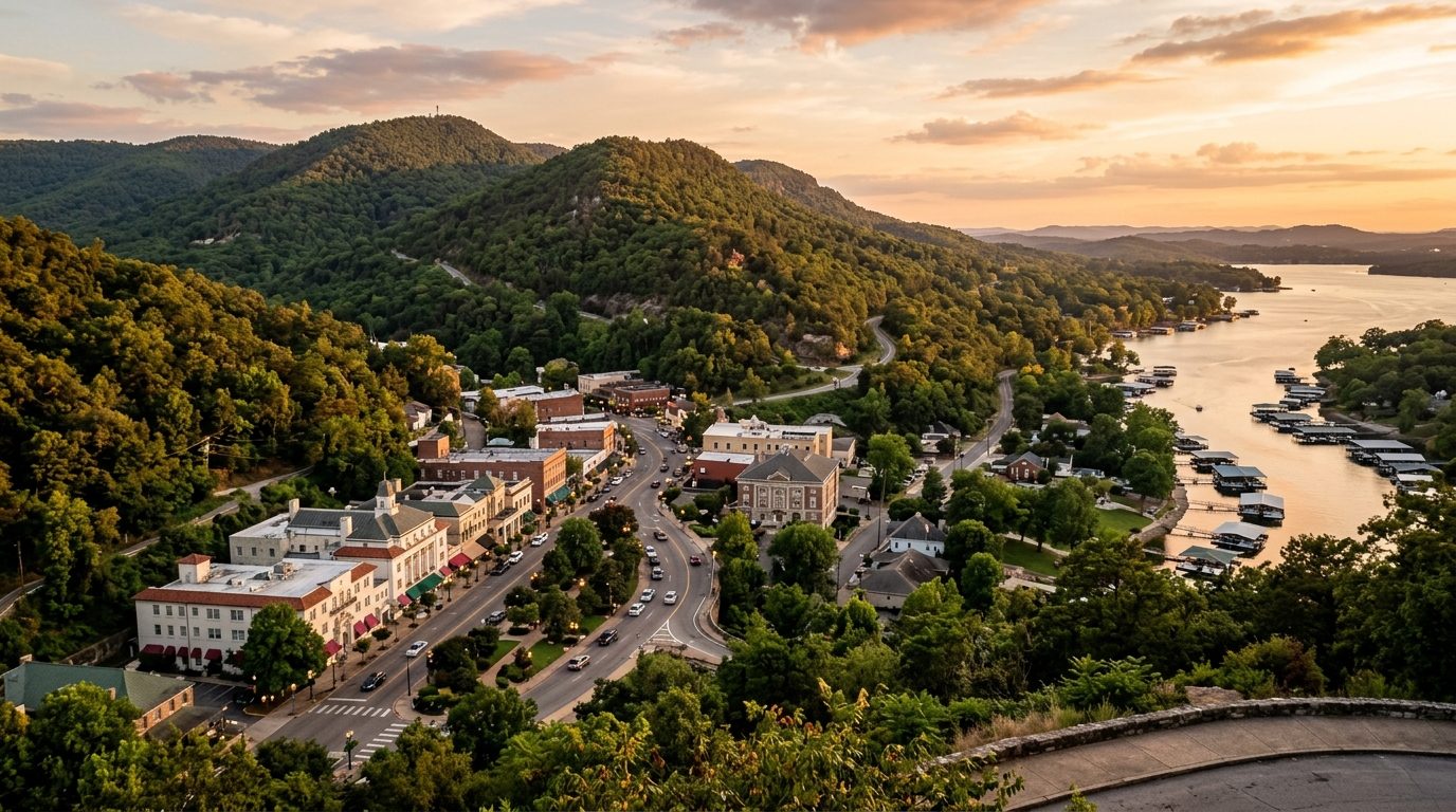
Hot Springs sits in a valley of the Ouachita Mountains, giving the metro a hilly, forested character rather than flat delta terrain. The city grew up around thermal springs on Hot Springs Mountain, and Hot Springs National Park’s wooded slopes reach into downtown, so the park and the historic business district share a boundary. Three reservoirs on the Ouachita River, Lake Hamilton, Lake Catherine, and the larger Lake Ouachita, wrap the city’s south and west sides. Housing reflects that history: a downtown core of early twentieth century masonry, Craftsman, and Colonial Revival houses near Bathhouse Row and Whittington Avenue; mid-century brick ranch homes on surrounding hills; postwar-era subdivisions; and lakefront homes with private docks along Hamilton and Catherine. The county beyond the city trends toward site-built and manufactured homes on larger wooded lots, plus golf-and-lake developments such as Hot Springs Village.
Price tier tracks water access and land character more than distance from downtown. Homes directly on Lake Hamilton and Lake Catherine, especially those with deep-water access and a permitted dock, sit toward the upper end, since shoreline lots are fixed in number and dock rights involve utility and federal permitting. Hot Springs Village and similar gated golf communities occupy a comparable upper tier, built around shared amenities and covenants. Lake Ouachita’s shoreline, largely national forest land, has fewer buildable lakefront parcels, holding it apart from surrounding areas. Inland and rural parts of the county, including Lonsdale, Fountain Lake, and Mountain Pine, trend lower, reflecting larger acreage lots, older housing, and distance from the lakes and downtown jobs. Downtown Hot Springs and its historic districts fall in between, varying with housing age and condition.
Tourism built around Hot Springs National Park anchors the economy, and Oaklawn Racing Casino Resort, combining live thoroughbred racing with year-round casino gaming, is among the largest private employers. Health care is a second pillar, led by CHI St. Vincent Hot Springs and National Park Medical Center, full-service hospitals drawing patients from surrounding counties. Government and education employment is significant for the metro’s size, spanning the city, Garland County, the school district, and National Park College. Manufacturing and aerospace add jobs through boat builder Xpress Boats and suppliers Radius Aerospace and Triumph Airborne Structures, alongside Berry Global’s plastics operations, with Walmart and Kroger among the larger retailers. Mountain Pine grew up around a single lumber and plywood mill that has since closed.
The climate is humid subtropical, with year-round rainfall, periodic winter ice storms that down trees and power lines, and a spring severe-weather season, though mountainous topography tends to moderate tornado frequency versus flatter parts of the state. Flood risk is localized to certain creeks and low spots near the lakes rather than metro-wide, so checking floodplain maps before purchase is worthwhile near lake coves. Lakefront ownership carries added regulation: Entergy, under its federal hydropower license, owns the shoreline and lake bottom of Lake Hamilton and Lake Catherine and governs dock construction there, while Lake Ouachita’s shoreline is largely national forest land, so buyers should confirm dock permitting and lease terms rather than assume standard ownership. Zoning differs between incorporated cities and unincorporated Garland County, and Hot Springs licenses and caps short-term rentals within city limits. Public transit is minimal, car dependence is the norm, and Little Rock’s larger airport is about an hour away.
Cities and Towns in the Hot Springs Metro Area
Notable Communities and Neighborhoods
Hot Springs Real Estate Market FAQ
How is the Hot Springs metro area organized geographically?
The metro is built around Hot Springs, which sits in a valley of the Ouachita Mountains with Hot Springs National Park’s forested ridges reaching into the middle of downtown. Three connected reservoirs, Lake Hamilton, Lake Catherine, and the larger Lake Ouachita, ring the city’s south and west sides, and outlying towns such as Diamondhead, Fountain Lake, Lonsdale, and Mountain Pine sit in more rural, forested parts of Garland County away from the lakes and downtown core.
Which parts of the Hot Springs area tend to carry higher prices, and why?
Property directly on Lake Hamilton and Lake Catherine, particularly with deep-water access and a permitted dock, tends toward the higher end because shoreline lots are limited and dock rights involve utility and federal permitting rather than ordinary ownership. Hot Springs Village and other gated golf-and-lake communities sit in a similar tier due to shared amenities and covenant-controlled development. Inland, rural, and outlying areas of the county generally trend lower, reflecting larger acreage lots, older housing, and distance from the lakes and downtown employment.
What should buyers verify locally before purchasing in the Hot Springs area?
Buyers should confirm a property’s flood-zone status against city or county floodplain maps, especially near creeks or lake coves. On lakefront property, it is worth confirming who controls the shoreline and dock permitting, Entergy under its hydropower license for Lake Hamilton and Lake Catherine, or the U.S. Forest Service for national forest shoreline around Lake Ouachita, since these are not standard private-lot arrangements. Buyers should also confirm whether a property falls under city or unincorporated county zoning, since permitting and short-term rental rules differ between the two.
What is a distinctive regional risk to be aware of in the Hot Springs area?
Winter ice storms are a periodic risk in the forested, hilly terrain, capable of downing trees and power lines, and spring brings the region’s main severe-weather season, though the mountainous topography tends to moderate tornado frequency compared with flatter parts of Arkansas. Flooding is a localized rather than metro-wide concern, tied to specific creeks and low-lying spots near the lakes, making a site-specific floodplain check a routine part of due diligence.
Nearby Markets