
Current real estate market data, news and analysis for the Amarillo, TX metropolitan area — 276,235 residents across 5 counties in Texas.
Data as of May 2026. Sources: Redfin Data Center, U.S. Census Bureau.
Latest Amarillo Real Estate News
Coverage of this market is coming soon. Browse all housing market news.
Amarillo Real Estate Market Overview
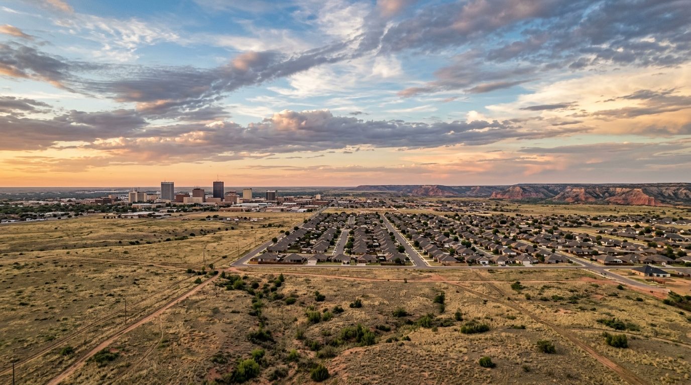
The Amarillo metro sits atop the Llano Estacado, a High Plains tableland marked by flat, wide-open terrain and few natural landmarks aside from the break of Palo Duro Canyon southeast of the city. Amarillo, with Canyon to the south, forms the urbanized core, while Panhandle, Claude, White Deer, Groom, Vega, and Adrian remain small rural towns surrounded by ranch and farm land. Housing stock in the core cities leans toward single-story brick ranch homes from the mid-twentieth century, mixed with newer brick-veneer construction on the growing western and southwestern edges. Lots tend to be generous, streets follow a grid in older sections and curve through newer subdivisions, and attached garages are standard. Outside city limits, homes in Armstrong, Carson, and Oldham counties sit on acreage tracts served by private wells and septic systems, not municipal utilities.
Southwestern Amarillo, including the corridor around Soncy Road, Coulter Street, and the western Loop, along with Canyon and the West Texas A&M University area, generally commands higher prices, reflecting newer construction, master-planned amenities, and proximity to newer schools. Established, tree-lined districts near downtown, with mature elm canopies and brick-paved streets, also draw a premium for character despite their age. Older central and northeastern parts of Amarillo, nearer the stockyards and industrial corridors, carry lower prices, reflecting older housing stock and fewer amenities. Rural acreage in the outlying counties varies by distance to town, with land near Palo Duro Canyon and Lake Tanglewood often priced for scenic value.
The regional economy has long been anchored in cattle feeding and beef processing; feedyards across the surrounding counties supply large packing plants operated by companies such as Tyson Foods and JBS, making the area one of the nation’s most concentrated beef-processing regions. Energy extraction, including natural gas and the helium-rich fields that once made Amarillo a global helium hub, continues to support drilling and processing jobs. The federal government is a major employer too, through the Pantex Plant east of the city, which assembles and maintains the nation’s nuclear weapons stockpile. Healthcare is significant too, led by hospital systems such as BSA Health System and Northwest Texas Healthcare System, referral centers for the Panhandle and eastern New Mexico. West Texas A&M University in Canyon adds stable education-sector employment and a steady stream of renters and first-time buyers south of the metro.
Buyers should weigh the region’s exposure to severe weather; the Panhandle sits within a recognized hail belt and sees frequent high winds, thunderstorms, and occasional tornadoes, affecting roofing condition, insurance premiums, and windstorm deductibles. Property taxes are levied locally with no state income tax, and rates vary by city, county, school district, and special district, so buyers should confirm exact taxing jurisdictions before purchase. Public transit is limited to a small municipal bus system, so most residents rely on personal vehicles and road access matters more than transit proximity. Amarillo enforces zoning and platting within city limits, while unincorporated parts of surrounding counties have fewer land-use restrictions. Growth has pushed outward toward the southwest along the Loop, tracking new commercial and school development, while older sections near downtown see slower reinvestment. Because the region drains poorly into playa lakes rather than rivers, buyers should verify drainage and flood history independently, and in unincorporated areas confirm well water quality, septic condition, and mineral rights status before closing.
Cities and Towns in the Amarillo Metro Area
Notable Communities and Neighborhoods
Amarillo Real Estate Market FAQ
How is the Amarillo real estate market organized geographically?
The metro centers on the city of Amarillo, which spans Potter and Randall counties, with the college town of Canyon just south along Interstate 27. Smaller communities such as Panhandle, Claude, White Deer, Groom, Vega, and Adrian sit along the highway corridors that radiate outward into Armstrong, Carson, and Oldham counties, transitioning from urban and suburban subdivisions near Amarillo’s core into ranch and farm land the farther out you go. Within Amarillo itself, growth has generally moved outward from downtown toward the west and southwest, following successive rings of postwar and contemporary development.
Which parts of the metro tend to be pricier, and why?
Southwestern Amarillo and Canyon, including areas near West Texas A&M University, tend to command stronger prices because of newer housing stock, master-planned amenities, and proximity to newer schools and retail. Established close-in neighborhoods with mature trees and historic character also carry a premium despite their age. Older sections nearer downtown, the rail corridors, and industrial areas tend to be more affordable, reflecting smaller and older housing stock and fewer nearby amenities.
What should buyers verify locally before purchasing in this market?
In unincorporated parts of the surrounding counties, buyers should confirm whether a property relies on a private well and septic system rather than municipal water and sewer, and have both inspected before closing. Because the region is prone to hail and high wind, buyers should also review a property’s roof condition and confirm what windstorm and hail coverage costs and requires. Given the area’s flat terrain and poor natural drainage, it is also worth checking a property’s proximity to playa lakes and its drainage and flood history with the city or county before purchase.
What is a distinctive regional risk buyers should understand about the Texas Panhandle?
The Panhandle sits within a recognized hail belt and experiences frequent severe thunderstorms, high winds, and occasional tornadoes, which shapes roofing needs and insurance costs across the metro. The region’s economy and water supply are also tied closely to agriculture and the Ogallala Aquifer, the underground water source that supports much of the area’s irrigated farming and rural water systems; because the aquifer recharges slowly, water availability is a long-term consideration for rural and agricultural property in particular.
Nearby Markets