
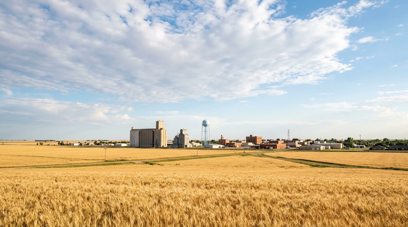
Current real estate market data, news and analysis for the Enid, OK metropolitan area — 61,779 residents across Garfield county.
Data as of May 2026. Sources: Redfin Data Center, U.S. Census Bureau.
Latest Enid Real Estate News
Coverage of this market is coming soon. Browse all housing market news.
Enid Real Estate Market Overview
Enid sits on the eastern edge of the southern Great Plains in north-central Oklahoma, roughly ninety miles north of Oklahoma City, on the flat wheat country opened by the 1893 land run that settled the Cherokee Outlet. Rapid growth as a railroad and grain-shipping center left a core of pre-1920s housing — Craftsman bungalows, Foursquares, and larger Victorian and Prairie-style homes — concentrated in the historic districts northwest of downtown. Surrounding that core are blocks of mid-twentieth-century brick ranch homes built as the city expanded after World War II, while newer single-family subdivisions with larger lots continue to be platted on former farmland along the south and southwest edges of town. Smaller Garfield County towns nearby tend toward older farmhouses and manufactured homes on acreage.
Homes inside the Kenwood and Waverley historic districts near downtown draw interest for their architecture and mature trees, though condition varies house to house and older wiring, plumbing, or foundations are common concerns. The south and southwest sides of Enid, where newer subdivisions have been built on open farmland, generally offer newer construction and larger lots and sit toward the upper end of the local market. Areas nearer the rail corridors and grain elevators north and east of downtown, including the historically Black East Park and Southern Heights communities, tend to have older, smaller homes at the lower end of the price range. The small incorporated towns scattered across Garfield County offer a lower-density, more rural alternative to living inside Enid proper.
Enid’s economy is anchored by agriculture and the military. Vance Air Force Base, home to the 71st Flying Training Wing, is a major U.S. Air Force pilot-training installation and a steady source of federal and civilian contractor employment. The surrounding countryside is major wheat country, and Enid’s grain elevators, among the largest storage complexes in the country, still anchor an agribusiness sector spanning grain handling, seed and fertilizer supply, and food manufacturing. Energy has long been part of the local economy, from the oil and gas industry that built much of downtown Enid to Koch Industries’ nitrogen fertilizer plant nearby. Healthcare is another major employer, with INTEGRIS Bass Baptist Health Center and St. Mary’s Regional Medical Center operating hospital campuses in the city, alongside area public schools and Autry Technology Center.
Enid lies within Tornado Alley, and severe spring thunderstorms capable of producing large hail and tornadoes are part of the normal climate; a violent tornado struck neighborhoods on the south side of the city in spring 2026, underscoring the value of checking a property’s storm history, the presence of a safe room or shelter, and current wind and hail insurance terms before closing. Property taxes are assessed at the county level and include a homestead exemption for owner-occupied homes, so buyers should verify current assessments and any local bond levies. The metro has no fixed-route mass transit of note, and development is low-density and auto-oriented. Land on the urban fringe continues converting from farmland under city zoning and platting rules, and some outlying parcels rely on private well and septic systems. Homes near Vance Air Force Base may sit within noise or land-use compatibility zones worth checking, and renovations in the historic districts can be subject to local design review.
Cities and Towns in the Enid Metro Area
Notable Communities and Neighborhoods
Enid Real Estate Market FAQ
How is the Enid, Oklahoma housing market organized geographically?
The market centers on Enid itself, with an older core of homes near downtown and the historic districts, a ring of mid-century neighborhoods built as the city expanded outward, and newer subdivisions on the south and southwest edges where farmland continues to be developed. Beyond the city, Garfield County includes several small incorporated towns and unincorporated rural areas that offer a lower-density, acreage-oriented alternative.
Which parts of the Enid metro tend to be pricier?
Newer subdivisions on Enid’s south and southwest side, built with larger lots and modern construction on former farmland, generally sit at the upper end of the local market. The Kenwood and Waverley historic districts near downtown command interest for their architecture and mature landscaping. Areas closer to the rail corridors, older industrial sites, and grain elevators north and east of downtown tend to have older, smaller homes at lower price points.
What should buyers verify locally before purchasing in the Enid area?
Confirm whether a property has a safe room or storm shelter and check its storm and insurance claim history; verify the current Garfield County property tax assessment and any local bond levies; confirm whether the parcel is served by city water and sewer or relies on private well and septic; check for historic-district design-review requirements on any exterior renovation; and, for property near Vance Air Force Base, review whether it falls within a published noise or land-use compatibility zone.
What is the tornado and severe weather risk in Enid, and how does it affect insurance?
Enid sits within Tornado Alley, and the region experiences a regular spring and early-summer severe weather season that can bring large hail and tornadoes, including a violent tornado that struck the south side of the city in spring 2026. Buyers should expect wind and hail coverage, deductibles specific to those perils, and the property’s storm history to be significant factors in obtaining and pricing homeowners insurance, and should ask directly about the presence of a storm shelter or safe room.
Nearby Markets